Why do more cyclones form over the Bay of Bengal than the Arabian Sea?
Both seas beside India can produce cyclones, but historically more have formed over the Bay. Warmth, moisture, initial spin and wind shear help explain the difference.

Why India Looks This Way
On 12 October 2026, the India Meteorological Department (IMD) dedicated a new public map for cyclone warnings and marine weather ahead of the October–December season. It brings tracks, wind, rain and coastal hazards together. But the two seas beside India do not produce cyclones equally often: why have more formed over the Bay of Bengal in the east than over the Arabian Sea in the west? Ministry of Earth Sciences release.
What does “more cyclones” count?
A patch of low pressure is a possible beginning, not yet a cyclonic storm. To compare the two seas, researchers count where weather systems first formed and follow which ones later reached the same storm-strength threshold. That is different from counting storms that crossed a coast.
In one 1980–2019 comparison, 130 systems formed over the Bay and 63 over the Arabian Sea, then reached tropical-storm strength: about two Bay systems for every Arabian Sea system. These are historical counts, not a forecast for any year.
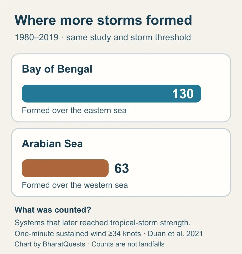
Chart by BharatQuests. Data: Duan and colleagues, 2021. Formed in basin, later reaching tropical-storm intensity: one-minute sustained winds ≥34 knots. Not landfalls.
What lets a cyclone form?
Warm seawater supplies heat and water vapour to the air above it. Moist air rises; when the vapour condenses into cloud, it releases heat that can help more air rise. For those clouds to organise into a spinning storm, the atmosphere also needs an existing disturbance and enough rotation. Dry air entering the middle of a developing system can weaken its clouds.
Another obstacle is vertical wind shear: a large change in wind speed or direction between lower and higher levels. Imagine a developing column of storm clouds being pushed one way near the sea and another way aloft. Strong shear can pull that organisation apart. Warm water alone therefore cannot tell us how many cyclones a sea will produce. IMD's cyclone science plan explains the ingredients.
Why has the Bay been more favourable?
Both seas can supply warm water. In the 1980–2019 comparison, the Bay had a more favourable combination of moisture, initial spin and wind shear. Its middle atmosphere was especially moist relative to the Arabian Sea after the summer monsoon. That can help rising storm clouds persist. Duan and colleagues, 2021.
Timing matters too. During the summer monsoon, moist air over both seas can coincide with strong shear that works against cyclone formation. Before and after the monsoon, the balance can become more favourable. The study found the biggest contrast between these seas after the monsoon. Duan and colleagues, 2021.
The Arabian Sea can still produce serious storms when the ingredients align.
What does that mean for India's coasts?
Formation is only the first step. A storm's path determines whether it reaches land; its winds, rain and storm surge—a temporary rise in coastal water—determine what places need warnings. IMD's historical landfall atlas describes many Bay storms reaching India's east coast or the coasts of Bangladesh and Myanmar. Arabian Sea storms can threaten western shores too; IMD identifies Gujarat as the most exposed Indian west-coast landfall area for storms originating there. Some systems in either sea weaken before landfall.
Fishers, ports and coastal residents therefore need a forecast for the particular storm and place, even when the long-term count is lower on their side of India. A live warning map answers where the hazards from a developing system may go next.