Why do the Narmada and Tapi flow west?
These two long rivers head for the Arabian Sea while many major peninsular rivers drain east. Their valleys provide the downhill route west.

Why India Looks This Way
The Central Water Commission describes two rivers that begin inland in Madhya Pradesh and reach India's western coast: the Narmada rises near Amarkantak, and the Tapi near Multai. Both head towards the Arabian Sea. Many other large peninsular rivers flow east towards the Bay of Bengal. Why do these two go west?
A river follows a valley, not a regional rule
Water moves downhill under gravity. Rain falling on one side of a high ridge can drain towards one river; rain on the other side can enter a different system. The area from which water drains into a river and its tributaries is its drainage basin. The high ground separating neighbouring basins is a divide. These are ways of reading the terrain, as the US Geological Survey explains.
Much of the Deccan Plateau stands higher in the west and slopes gently east, according to NCERT's physical geography text. That broad tilt helps explain why major peninsular systems such as the Godavari, Krishna and Kaveri drain east. Each river, though, follows the downhill route available from its upper catchment to an outlet.
The Narmada and Tapi have westward corridors
The Narmada runs from the Amarkantak area through a long valley between the Vindhya high ground to its north and the Satpura high ground to its south. The Tapi begins near Multai, south of the Satpura, and continues across Maharashtra and Gujarat. The Central Water Commission's basin accounts place their western outlets near Bharuch and Surat respectively. The rivers occupy separate, broadly parallel corridors.
A Gujarat government geology account describes the courses of both rivers as following faulted planes or rift valleys. Movements along fractures in the Earth's crust helped shape long troughs in the terrain. The rivers follow the downhill paths through those troughs: the faults help explain the shape of the routes, while the westward fall of the valleys makes the water move west today.
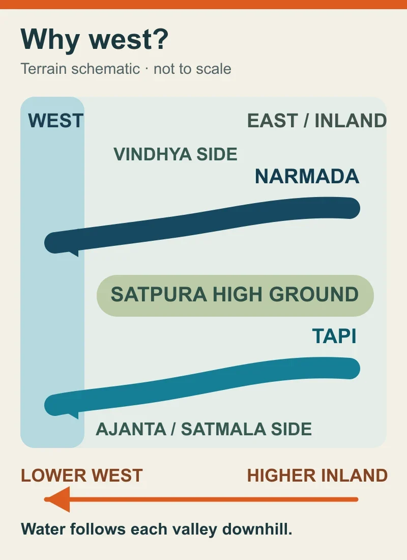
Terrain schematic, not a map or to scale. The arrows show the rivers' westward drainage through separate valleys, with Satpura high ground between them; they do not trace exact channels or basin boundaries. Sources: Central Water Commission basin descriptions and Gujarat government geology. Diagram: BharatQuests.
Picture a broad roof that slopes one way but has a deep gutter running across it. The roof's tilt suggests one direction; water in the gutter follows the gutter. The plateau's broad slope and these rivers' westward valleys work at different scales in much the same way.
What does that direction change for people?
The river routes show which places share a drainage basin. The Central Water Commission's basin descriptions place the upper parts of these systems in Madhya Pradesh and their lower courses in Gujarat, with the Tapi also crossing Maharashtra. Tributaries and runoff connect places across state boundaries, while basin divides follow the terrain.
Following a river's route helps show where water from an upper catchment may travel and why changes there can matter downstream. How much reaches a particular town also depends on rainfall, season, storage and withdrawals.
Other rivers flow west too: the same Gujarat geology account names the Mahi and Sabarmati. Narmada and Tapi stand out for their long westward valleys across a region where many other large rivers run east.