Why can a thunderstorm drench one neighbourhood and miss another?
A thunderstorm's rain patch can be much smaller than the area covered by a weather warning. See how the patch moves and what an IMD alert tells you about your street.

Why India Looks This Way
In its 12 October 2026 bulletin, the India Meteorological Department (IMD) reported moderate rain with thunderstorm and lightning at most reporting places in Delhi during the preceding 24 hours. It also issued short-lived local weather alerts. The first statement describes rain already observed; an alert describes what may happen during its stated hours. Neither means every street in the area gets the same rain. IMD, 12 October 2026 bulletin.
Why can one neighbourhood be soaked while another nearby stays dry for the moment? Look at where a thunderstorm drops rain, and how that patch changes as the storm moves.
Why can nearby streets get different rain?
A thunderstorm can form when moist air rises and cools. Water vapour condenses into cloud droplets; the heat released helps the air continue rising. If the cloud grows tall enough, rain and lightning can develop. Warm, moist air and unstable conditions make this possible, while different weather features can provide the upward push. NASA's thunderstorm explainer.
Rain from a developing storm may fall over a small patch of ground. These convective showers can start and end quickly, with sharp differences over short distances. Winds move the cloud and its rain patch; a storm cell can also grow, weaken or be followed by another. Nearby streets can therefore lie inside and outside the rain at the same moment. Met Office, rain and showers.
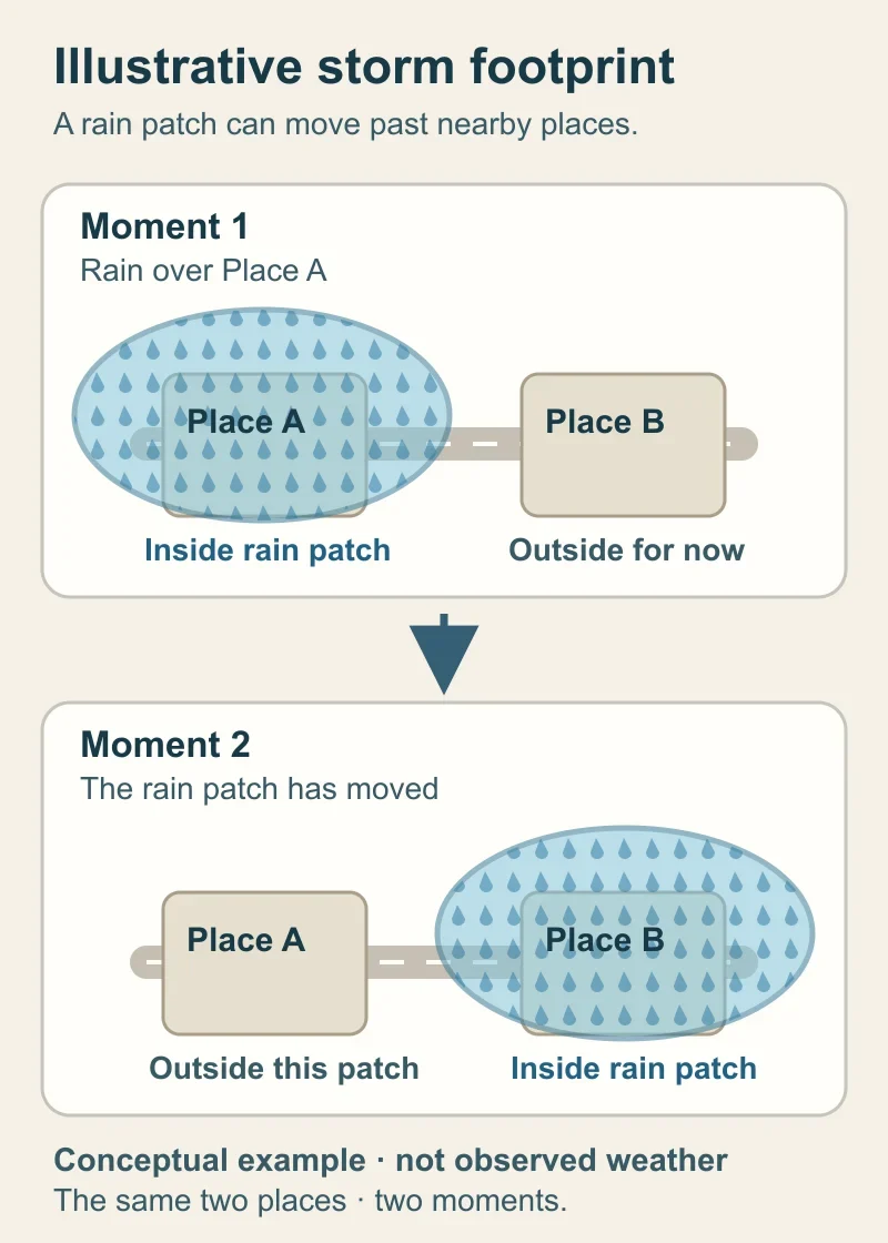
Illustrative storm footprint, not an observed map, radar image or forecast. The same two places are shown at two moments as a rain patch moves. Diagram: BharatQuests.
What determines where a shower forms?
Air does not rise equally everywhere. A change in wind direction can bring air together and force it upward. Terrain or a coastline can also help air rise in some places. Several shower clouds may develop along a line, so rain need not fall in one neat circle. These are general ways showers form; they do not establish which feature caused Delhi's rain on 11–12 October. Met Office on showers and convergence lines.
A place outside one rain patch may be under a moving or new shower later. A photograph of one dry road therefore cannot show what happened across a city, or what will happen at that spot in the next hour.
What does an IMD alert say about your street?
A district warning names an area and period in which a hazard may occur. IMD also issues more local station nowcasts. A nowcast uses recent observations to forecast the next few hours; it can change as the storm develops. Check the issue time, validity period and named area: a three-hour warning issued in the morning is no longer current in the afternoon. IMD's district and station nowcast page; IMD Bengaluru on three-hour station nowcasts.
Coverage words describe how widely rain is reported or expected, separate from how heavy it is. IMD uses isolated for rain at up to 25% of reporting stations in the specified area, and scattered for 26–50%. These are station-coverage categories, not the share of land that must get wet or the chance of rain at your house. IMD Ahmedabad bulletin, terminology on p. 3.
For outdoor work or travel, check the latest IMD nowcast for your area and its validity time. If thunder or lightning threatens, take shelter even if the ground where you stand is dry. IMD advises avoiding trees, water and conducting objects during such conditions. IMD, 12 October bulletin, safety advice.