Why is India’s western coastal plain narrower than its eastern plain?
The Western Ghats sit close to much of the west coast; broad lowland and major river deltas shape parts of the Bay of Bengal side.

Why India Looks This Way
On a physical map of India, the lowland beside the Arabian Sea appears as a thin strip. Beside the Bay of Bengal, it spreads much farther inland in several places. These are coastal plains: relatively low land between the shore and higher ground.
India’s National Portal describes a narrow strip between the Arabian Sea and the Western Ghats, and a broader coastal area between the Bay of Bengal and the Eastern Ghats. Two features help explain that pattern: where the high ground begins, and where large rivers have laid down sediment.
The hills are close to the western shore
Travel inland from the Arabian Sea across the western coastal plain, and the land soon rises toward the Western Ghats, the high edge of the Deccan Plateau. Because the Ghats run near the shore, there is relatively little low ground between them and the sea. SATHEE’s presentation of NCERT Chapter 2 describes this as a narrow plain and divides it into the Konkan, Kannad and Malabar stretches.
The width to look for is the distance across the lowland, from sea to higher ground. Tall hills do not by themselves make a narrow coastal plain; their distance from the shore matters. That distance changes along the western coast.
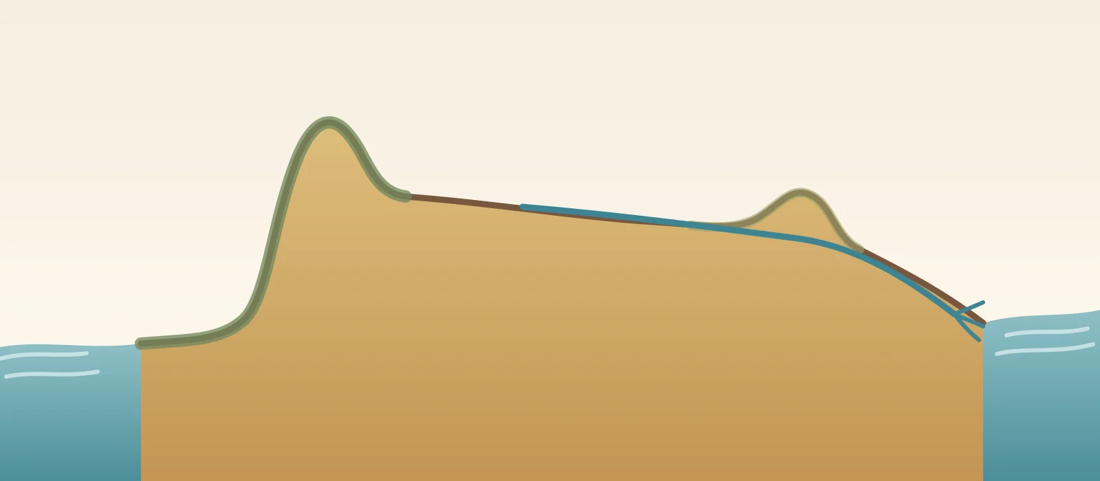
One continuous west-to-east schematic, not to scale. It shows a narrow lowland beside the Western Ghats, a broad plateau sloping east and a wider delta plain at the Bay of Bengal. Original diagram by BharatQuests.
Rivers help spread the eastern lowland
On the Bay of Bengal side, the plateau descends eastward and the Eastern Ghats are cut by river valleys. Several large rivers cross the eastern lowland before reaching the sea. They carry sediment downstream; some of it settles near their mouths, building low, branching delta plains over long periods.
SATHEE’s presentation of NCERT Chapter 2 identifies extensive deltas formed by the Mahanadi, Godavari, Krishna and Kaveri. These river-built areas help explain why the eastern coastal plain spreads out in major delta regions. The contrast is especially clear in Odisha’s official description: its coastal plain is widest around the Mahanadi delta and narrower to the north and south.
Odisha’s State Disaster Management Authority says flat coastal belts, poor drainage and river siltation can contribute to severe flooding in basin and delta areas. Such floods can damage paddy and other crops, homes and roads.
Why the contrast is not uniform
Neither plain has one fixed width. The Western Ghats do not stay the same distance from the shore, and eastern deltas widen particular stretches rather than the entire coast.